


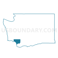
Castle Rock South Voting District, Cowlitz County, Washington
About
Outline

Summary
| Unique Area Identifier | 684094 |
| Name | Castle Rock South Voting District |
| County | Cowlitz County |
| State | Washington |
| Area (square miles) | 0.97 |
| Land Area (square miles) | 0.84 |
| Water Area (square miles) | 0.13 |
| % of Land Area | 86.53 |
| % of Water Area | 13.47 |
| Latitude of the Internal Point | 46.25745140 |
| Longtitude of the Internal Point | -122.89230590 |
Maps


Graphs
Select a template below for downloading or customizing gragh for Castle Rock South Voting District, Cowlitz County, Washington


Neighbors
Neighoring Voting District (by Name) Neighboring Voting District on the Map
- Castle Rock North Voting District, Cowlitz County, WA
- Heights Voting District, Cowlitz County, WA
- Salmon Voting District, Cowlitz County, WA
- Sandy Bend Voting District, Cowlitz County, WA